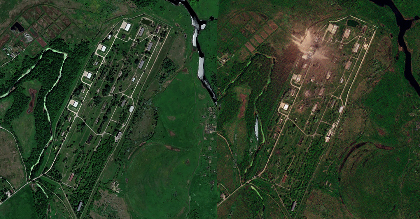
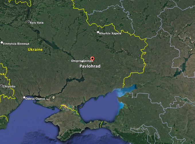
Satellite imagery The War Zone has obtained from Planet Labs, seen at the top of this story and below, shows much of a volatile materiel storage area in the eastern Ukrainian city of Pavlohrad (Pavlograd) absolutely obliterated by a blast earlier this week.
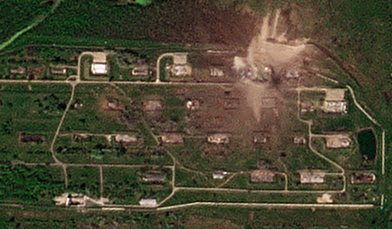
Author’s note: This story has been updated with high resolution imagery seen at the bottom of the post. The top shot was also replaced.

You can read more about what is already known about this explosion, which produced a massive visible shockwave, and the injuries and damage that it caused, in our initial reporting on this incident here.


The explosion occurred on the night of April 30-May 1 in Pavlohrad, which is situated in Ukraine’s eastern Dnipropetrovsk region. The blast looks to have been the result of a Russian cruise missile strike that local authorities said injured more than 30 people and caused damage to more than 100 residential, commercial, and municipal buildings. The Russian government acknowledged launching strikes, which it said were targeting materiel being amassed for Ukraine’s upcoming counteroffensive.

Pavlohrad is notably home to the Pavlohrad Chemical Plant, which has long been involved in work on missiles and rockets, including the Vilkha-M guided artillery rocket and the Neptune anti-ship missile. The firm has also been charged with storing rocket motors from Cold War-era SS-24 intercontinental ballistic missiles (ICBM), which were in the country and subsequently decommissioned after the collapse of the Soviet Union. Millions of landmines awaiting destruction following Ukraine’s accession to the international Mine Ban Treaty in 2005 are also reportedly kept there.

It remains unclear exactly what happened at the storage site north of Pavlohrad’s city center or what specifically caused the shockwave-inducing blast. The new satellite imagery does indicate that a single hangar-like structure at the northern end of the site was the source of the main explosion. Older imagery from Google Earth shows that the structure in question was surrounded on three sides by earthen berms, a common protective feature for buildings containing explosives.

The Planet Labs image from yesterday also shows clearly catastrophic damage to almost all of the surrounding buildings, many of which were also shielded by earthen berms. Video footage that bystanders shot at the time of the blast showed a number of secondary explosions, which would be in line with the damage in the new imagery.
Beyond the structural damage, when compared to older shots from Google Earth, the new Planet Labs image shows that the blast wiped away trees and other flora around a significant portion of the storage site.

The extent of the damage is perhaps unsurprising. Some have drawn comparisons between the visual spectacle of the explosion, and the resulting shockwave more specifically, and a nuclear weapon going off. Of course, as The War Zone has explored in detail in the past, the detonation of sufficiently large conventional explosives can produce some of the same general visual effects.
Even before Russia launched its all-out invasion of Ukraine in February 2022, residents in the area had repeatedly expressed concerns about the safety of the site.
“If we already have a strategic facility in the city with a large amount of explosive fuel, then under no circumstances should the disposal process be stopped,” one resident, Svitlana Shaperenko, told the BBC in 2020. “We’re just a ticking time bomb. If there’s an explosion, that’s the end.”
Even if Russia targeted the facility knowing it only was storing old highly volatile rocket boosters, which we do not know to be the case, a giant secondary explosion caused by the attack may have been the intended result. Regardless, that is what certainly happened with nearly the entire site, which was hardened to some degree, devastated.
Thankfully, whatever the specific source of the explosion and resulting shockwave at the storage site north of Pavlohrad this past weekend was, it being hit by Russian missiles did not result in the ‘end’ of the city as was worried. Although we do not know what else is stored in the same vicinity.
UPDATE:
We now have high resolution imagery showing just how massive the destruction at the site is and especially how huge the crater left by the major explosion is. You can also see a smaller crater just next to it, it is very possible this was caused by the initial blast from the Russian missile.
Also of note is another similar smaller crater on the south end of the installation, away from the major blast. This appears to be where one of the missiles stuck, but did not hit any major targets or cause a secondary explosion. The farthest southeastern major structure also may have been hit independently. Otherwise its lack of a berm proved devastating even quite far away from the major blast. Both of these details are highlighted in red.


This is just an initial assessment, there are likely other notable details in the imagery. We will update this post if we find more to share.
Contact the author: joe@thedrive.com
