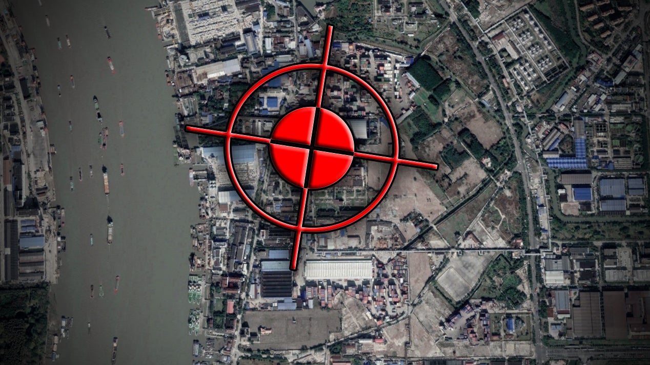
We posted a story yesterday about a bizarre series of events in Shanghai, China where vessels’ GPS data has been spoofed and jammed, along with that of various other users of the near indispensable system, including those that use fitness tracker apps. The folks that are studying the strange circumstances surrounding these anomalies say they are stumped as to how this is being done or why the fake location data correlates into a ring around a seemingly random area along the bustling Huangpu River. We don’t have an answer to those questions, but after a bit of research, we may have discovered a major clue that could help in doing so.
Make sure to read our story from yesterday by clicking here before continuing on for proper context and background.
After the post was published, I sat back and thought how strange it was the data was manifesting itself in a relatively small ring as described. After staring at the renderings of the data overlaid on a crude map for a moment, I thought along our typical lines here at The War Zone—what about hardware? Was this circular anomaly manifesting itself by design or is it actually a byproduct of the method in which the tactics are being deployed?
My gut said the latter.
With that in mind, and without getting into the weeds trying to dream-up the exact concept being executed here or the technology that enables it, I asked myself, what may be needed to make some sort of jamming and spoofing capability a reality within line of sight of the strange data ring? You are probably already thinking the same thing—the high ground. A radio antenna structure or high-rise could be essential and may have to do with the odd dispersion of coordinates.


Now it was time to find exactly where this was happening. We did not have the precise coordinates of where the ring was appearing, just very crude and zoomed-in maps posted by the researchers. We are used to this type of thing when it comes to image and geospatial intelligence gathering and within a few minutes, we found a match for the roadways and the orientation of the river shown in the two graphics we had. There was no question as to the accuracy of the anomaly’s location.
And what do you know? Right in the center of where the ring of data points was located was a huge smokestack—one of two that are part of a sprawling plant operated by Shanghai Gaore Industries. Bloomberg describes the company as a distributor of “coal and other minerals and ores.”
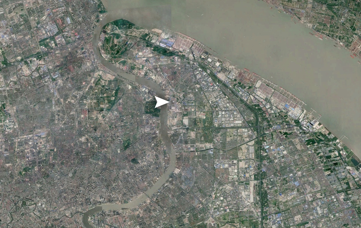
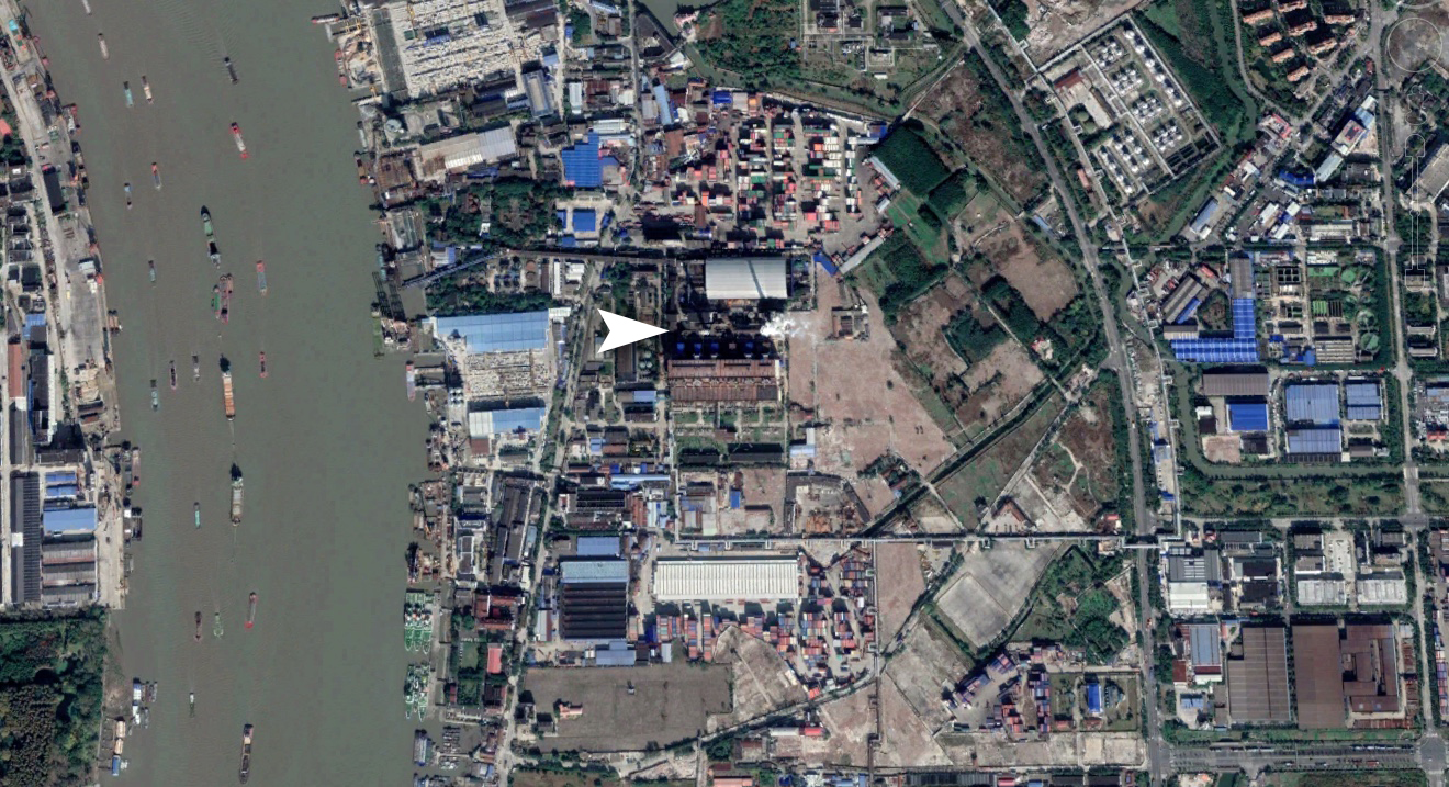
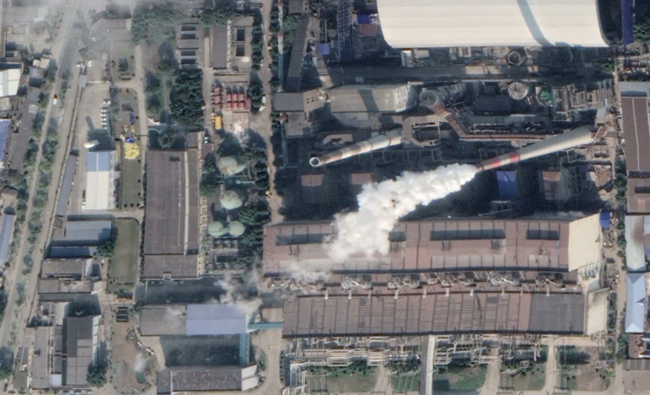
In the available satellite imagery, the smokestack appears to be hundreds of feet high, offering a perfect perch for which to install whatever gear could be involved in this GPS data tampering operation. The location also appears to offer unique lines of sight of the river both in front of the nearby perpendicular bank and down through where the river curves at both its north and south ends, at least to some degree. Even the main channel to the east would have been in range.
There was only one problem, would a working smokestack really be conducive to also working as an electronics mounting platform? Maybe so, and the stack in question looks like it has a number of catwalks installed a collar-like arrangement at various heights, but it still seems like a complication.
Once again, what do you know? This particular stack seems to be entirely dormant or abandoned, with its nearby twin bellowing away consistently in satellite imagery. In fact, in all the satellite photos we could find, the smokestack in question hasn’t emitted anything going all the way back to 2011.
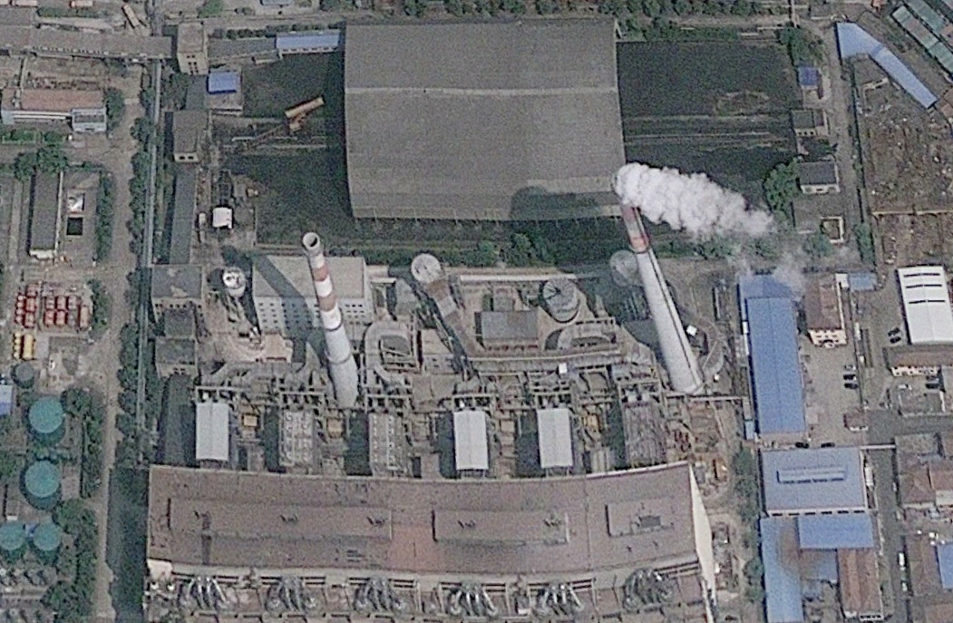
Still, just because something exists exactly where you hypothesized it would, that doesn’t mean it is being used for what you think it is. Coincidences happen all too often when it comes to these kinds of situations. In addition, it is easy enough to attach aerials and arrays to an abandoned smokestack, but still, it isn’t exactly a purpose-built radio tower.
An yet again, exactly that appears in the timeframe when supposedly, at least to our knowledge, these anomalies began occurring. After reviewing dozens of proprietary satellite photos spanning the last two years, out of nowhere, on the road just next to where the smokestack is located, a remarkably tall red radio tower pops up out of literally nowhere in the second half of 2018. At first, I thought it may be a crane, but I cannot see any sort of swing arm in any of the satellite images I have reviewed, nor is there any signs of construction. In fact, it looks exactly like a very tall radio tower, appearing similar in height as the smokestack just a stone’s throw away and plunked down right in the middle of the road located on the western edge of the plant.
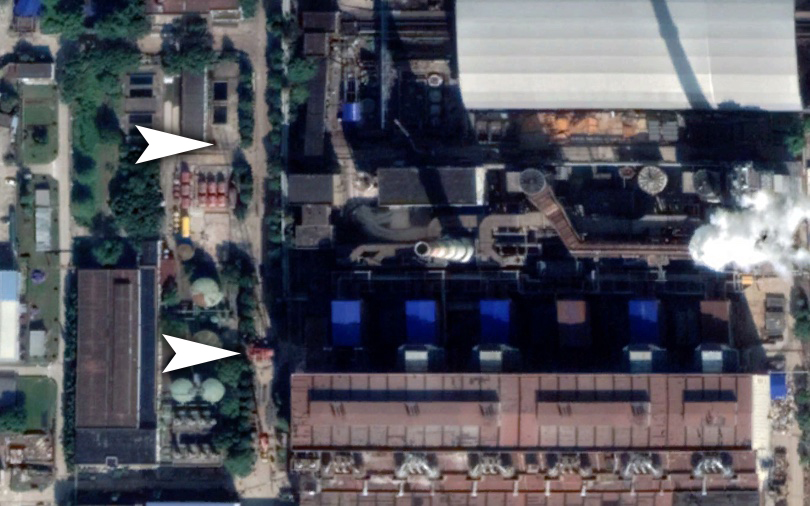
From what we can tell, the tower disappeared right around the end of 2018 or the first days into 2019. I have no idea if it had been moved to another area or if its functions were transferred to the smokestack or whatever, but its presence correlates with the available geolocation ‘ring’ data perfectly. The timeframe in which it is present and how it relates to that same data temporarily remains a question that we are looking into.
Taken as a whole, this evidence points to the possibility that some sort of hardware is present at the center of the mysterious ring. If that is indeed the case, we still don’t know who that hardware may belong to or what that entity’s goals are. Still, the presence of a very high perch exactly where I thought it would be may help investigators to come up with new hypotheses as to what exactly is happening and how it is happening. I certainly have my own ideas, but we’ll save those for another day.
Contact the editor: Tyler@thedrive.com
