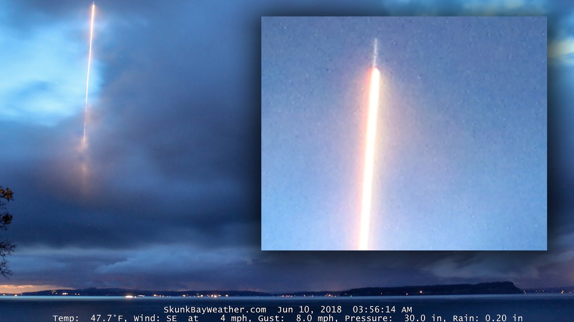
Social media has been buzzing about a bizarre photo captured by Skunkbayweather.com, a local weather website that also runs a number of webcams located near Hanesville, Washington. The site’s cameras look across the Puget Sound at Whidbey Island from Skunk Bay and one of them takes time-lapses of the undeniably picturesque setting. Just before 4am on Sunday, June 10th, that camera caught what at first glance looks like the impossible—a rocket launch that seems to be emanating from or near Naval Air Station Whidbey Island.
The photo looks downright impressive as the streak of light appears from behind low, broken cloud cover and rises towards the heavens. Adding to the picture’s intrigue, what looks awfully similar to a large rocket can be seen at the end of the light trail in an extreme crop of the image. But how is that even remotely possible? The Naval Air Station, which I have been all over on numerous occasions, has no rocket operations of any kind. Furthermore, there aren’t any launch facilities in the region that could even begin to explain this photo. The closest thing to something like that would be the Ohio class nuclear ballistic missile submarines (SSBNs) based not too far away at Bangor Trident Base/Naval Submarine Base Bangor, but those apocalyptic machines don’t launch missiles in the Puget Sound even for testing.
We contacted the owner of Skunkbayweather.com and they were very forthcoming with information and were happy to answer detailed questions regarding the photo as part of our investigation. They sent us the link to the entire timelapse which you can watch here, and went over the specific angle and field of view that the camera catches, as well as the camera type and its settings:
“It is a Canon T3 Rebel set up as a webcam. Images are captured about every 40-45 seconds. 3.5/20 second exposure/ 1600iso. I only run it on clear nights or when there could be severe weather.”
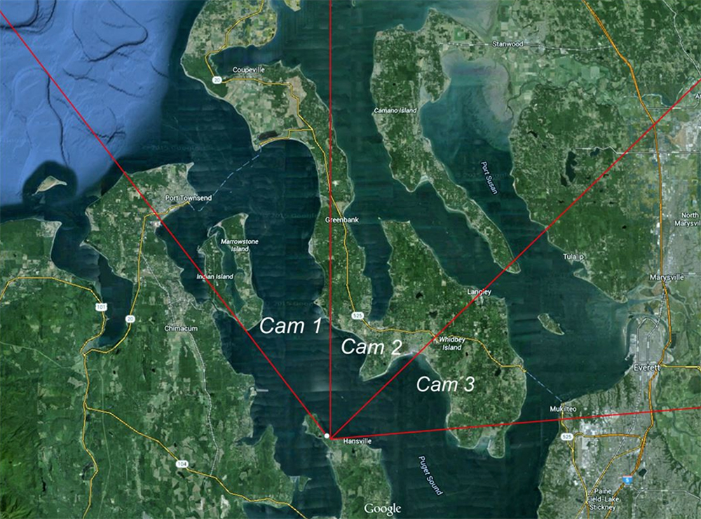
The positioning of the camera is roughly shown in the chart below, which is from Skunkbayweather.com, discusses the webcams functions and positions. The site’s owner told The War Zone:
“This was actually taken with “Cam4″, which is a little wider angle than Cam2 and pointing in the same direction.”

There were absolutely no indications that the owner of the site was trying to scam anyone or perpetuating a hoax. They seemed just as puzzled as anyone as to the picture’s origins and are seeking a good explanation for it.
With this information in hand, we reached out the Naval Air Station Whidbey Island to see if there were any aircraft operations around the time of the photo. Not surprisingly, there weren’t. The public affairs officer went to air operations directly to confirm this for us. We then reached out to Seattle Center’s public relations representative and they checked into it and said the FAA had no idea what it was and had no anomalies on radar or strange reports that morning that would explain the image.
I happen to be experienced with complex time-lapse photography. It’s worth noting that this type of photography can result in the appearance of distorted time and space in multiple ways. You are looking at a two-dimensional image of a complex 3D event, under unique lighting and environmental circumstances. What looks like a rocket being traced by its own exhaust plume as it rises into the heaves can actually be an object on a flat or even a descending profile coming towards you, or even an object moving away. Long distances traced by light can appear short and vice-versa, depending on the depth of the light being traced. The fact that the exposure lasts seconds, not fractions of a second, can also complicate making an accurate initial interpretation, but that information can also be beneficial when trying to decipher a mysterious image like this one.
One of the reasons we inquired for specific details about any air operations at NAS Whidbey Island at the time, including low approach or terminal operations of transient aircraft, is that we thought the image could be a fighter taking off from NASWI in afterburner and executing a high-performance climb. These dramatic maneuvers are common at some fast jet bases. But in this case, the early morning timing made such an explanation a long shot, as well as the lack of complaints that would have resulted in such a thunderous racket at 4am local time.
Next, we pulled up Flightradar24’s tracking of aircraft in the vicinity of Skunk Bay around the time the photo was shot. You can see a video of those movements below. Note that time is UTC, not local.
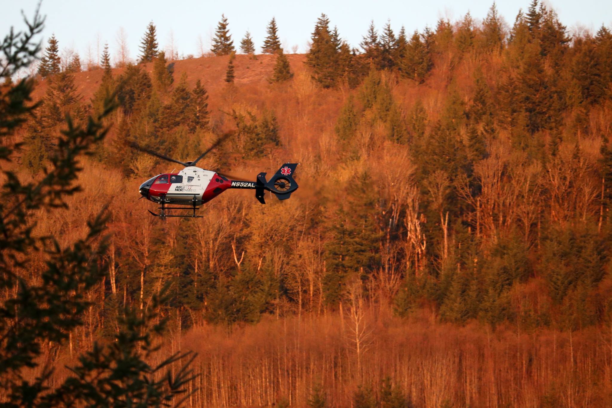
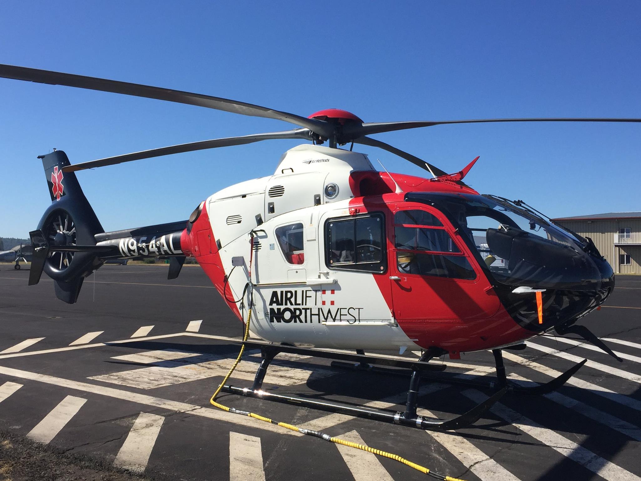
The Alaska Airlines jet (ASA94) descending from the northwest would have been out of the frame of the camera, although at first, it looked like a possible explanation as either the aircraft’s lights or its contrail could have possibly caused the illusion. Then we noticed an air ambulance helicopter—an EC-135T2+ registered as N952AL belonging to Air Methods—flying right in the vicinity of the Skunk Bay when the image in question was captured.

You will notice that there is an error with the tracking of the low flying helicopter that makes it freeze on the screen momentarily and Flightradar24 even notes this automatically. Then the chopper seems to dash across the channel at unbelievable high speed. This is an anomaly with the tracking, and in reality, the helicopter made its way across the channel at normal speed (around 115 knots at 2,000 feet) right around the time the photo was snapped and exactly where the streak is shown.
With this revelation in mind, the explanation of what you are seeing in the image is the helicopter moving away from the camera towards NAS Whidbey Island, just as it was tracked in the moments after the photo was taken. There is about a minute and a half time difference between the flight data and the time index on the photo. It’s likely one of the clocks was slightly off in reference to the data being displayed and we know the helicopter speed data is not fully accurate due to the tracking anomaly anyway.

When the image is interpreted in that fashion, you can see how the aircraft began being traced by the long exposure starting near the camera and moving away. As a result, it was also much closer to the camera, lower in altitude, and covered far less distance in the short 20-second exposure than a rocket blasting into the heavens far off in the distance would. At 115 knots the helicopter would have covered roughly 3,900 feet. The cloud it disappeared into would also be far closer to the camera when interpreting the image in this way. And all this actually works remarkably well just by shifting the notion of what you should be seeing in the image.
The thing that looks like a rocket at atop a flame would have been a ‘ghost image’ of the part of the helicopter that was exposed from spill-over from its running lights and the low available light in the environment. This can look nothing like the actual object as the long exposure and how the light plays on the object can result in strange and often elongated shapes—in this case, something like a ghostly image of a rocket.
So there you have it, sadly this wasn’t anything more exciting than a helicopter flying in a straight line in the wee hours of a quiet Sunday morning on the picturesque Puget Sound. Above all else, this photo serves as another reminder that sometimes there is much more to an image than what immediately meets the eye.
Update: 7:30pm PST—
Airlift NW has confirmed the Flighradar24 ADS-B data:
Update: 3:22pm PST—
Airlift Northwest just hammered the final nail in the conspiracy theorist’s coffin on this one:
Contact the author: Tyler@thedrive.com
